
|
Manzanillo Sightseeing |
| Home Page | About Us | city Description | Hotels | Villa, B& B's | Restaurants | Golf + Activities | Sightseeing | Destination Services | RV/Trailer Parks & Hostels | Travel Value Packages | Airlines | Other Cities in Mexico | What's New | General Info | State Map | Regional Map | Country Map | Books + CD's | Blog |
| Nearby Cities -> | La Huerta | Barra de Navidad | Cihuatlán | Isla de Navidad | Tenacatita |
|
Local Sights Playa La Audiencia Directions Santiago Bay Description Beautiful cove with golden sand beach named for the "audiencia" celebrated by the Provincial Bishop in the late 16th Century to bid farewell to the Spanish fleet commissioned by the King of Spain to find the "Riches of the Orient". Nearby Sights 
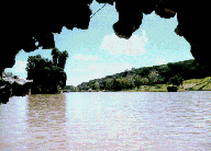
Laguna de Cuyutlán Directions 30 miles southeast of Manzanillo along the Pacific Ocean. Description A brackish water lagoon separated from the Pacific by a narrow strip of tropical foliage - haven to tropical flora and fauna. Laguna La María Directions Close to Manzanillo Description Popular haven for bird watchers. 
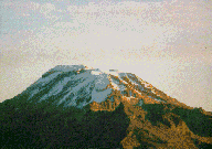
Volcan de Colima Directions Drive south along Cuyutlan Lagoon for about thirty-five miles and then head north on the Guadalajara highway for about forty-five miles to the Volcan de Colima National Park. Description At 4,240 meters in elevation, the Nevado de Colima is the sixth highest mountain in Mexico. It's neighbor, the Volcan de Colima - elevation 3,820 meters - is an active volcano last erupting in 1991. Both peaks offer challenging climbing opportunities. |
| Home Page | About Us | City Description | Hotels | Villa, B& B's | Restaurants | Golf + Activities | Sightseeing | Destination Services | RV/Trailer Parks & Hostels | Travel Value Packages | Airlines | Other Cities in Mexico | What's New | General Info | State Map | Regional Map | Country Map | Books + CD's | Blog |
|
Based on information contained in the Mexico Travel Database on October 31, 2011 |
| Powered by Dataperfect |